by Lauren Gilbert
Woking is a vibrant modern community in Surrey, England. The buildings in the city centre are modern, and there is no real sign of great age at first glance. The modern architecture and easy commuter access to London could lead one to assume that it is a completely modern city built for convenience. However, this initial impression is quite false. Woking is a parish that consists of multiple communities, including Woking village, Horsell, Mayfield, Brookwood and others. (It can be hard for the visitor to tell when going from one to another, as building has filled in the area.) The area appears to have been settled for centuries. Burial mounds going back thousands of years and the ruins of a small Roman settlement attest to Woking’s ancient roots. Originally listed as Wochingas or Wochinges, monks settled in the area possibly as early as the 8th century, and the area was a royal property from early times. The original town, now known as Old Woking Village, was a market town that appears to have been established on or near the site of the Roman settlement. In the old village, St. Peter’s Church was established in the 11th century, with subsequent additions. For example, the nave was constructed in the 11th century while the tower was built in the 13th century. Its name has been given to the borough and to the modern city as well.
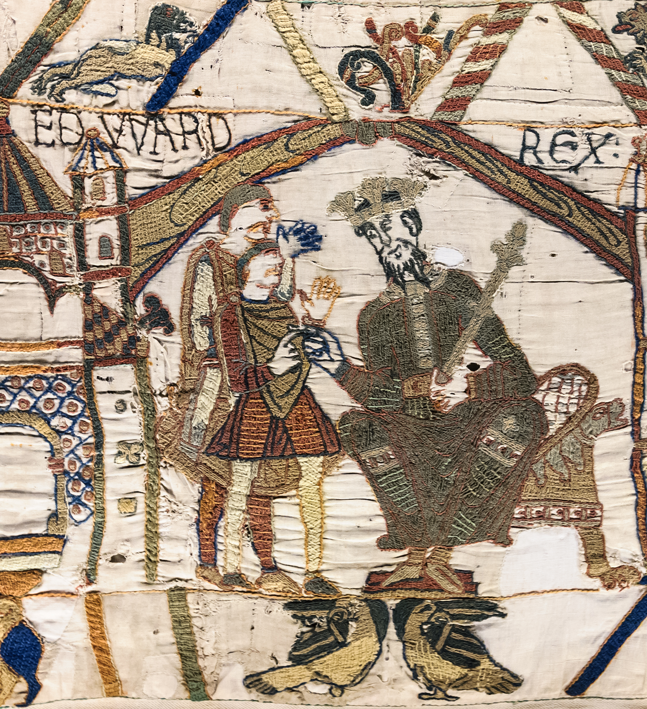
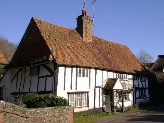
The Domesday Book shows Woking in William the Conqueror’s hands in 1086, and a manor there was previously known to be held by Edward the Confessor. The manor was held by the Crown until King John granted it to Alan Basset for a knight’s fee in the early 13th century. It stayed in Basset’s family, eventually coming into the hands of Hugh le Despenser (his mother was the granddaughter of Alan Basset). However, Hugh was executed in1326 and the manor of Woking reverted again to the Crown. During its history, the manor changed hands many times. However, ownership by the Beaufort Duke of Somerset ultimately prevailed. Upon becoming king, Henry VII granted the property to his mother, Margaret Beaufort, who was the daughter and heiress of John Beaufort, 1st Duke of Somerset. Margaret did quite a lot of building there, converting it from manor to palace. After convincing Margaret to give it to him, Henry VII also added to the palace. It seems to have been a favoured residence of Margaret’s until her death and it remained a popular house among the Tudors, visited by Henry VIII many times, Edward VI once, and Elizabeth I on occasion in turn. Henry VIII and Elizabeth I had their own building projects on the site. In 1620, James I gave the property to Sir Edward Zouch. He built a new house, abandoning the palace, and turned the park into farmland. Sir Edward died June 7, 1634 and there is a memorial to him in St. Peter’s Church. Available data indicates the palace was never occupied again, and that material from the palace may have been used in other local building projects, including Sir Edward’s new house. The palace subsequently became a ruin. Woking Borough Council bought the site in 1988. Archaeological digs are on-going.
Woking played an important role in cremation. As a method for disposing of dead bodies, cremation was common in the ancient world. However, with the rise of Christianity, cremation was disapproved and even became a crime under Charlemagne in 789, due to belief in the physical resurrection of the body. There were circumstances when cremation was used in spite of the disapproval of the church, such as times of epidemics, famines or following battle when there were large numbers of corpses requiring disposal. Cremation was considered illegal in England. In time, the health reasons for cremation gained support and Professor Ludovico Brunetti of Padua displayed his mechanism for cremation at the Vienna Exposition in 1873. In 1874, Sir Henry Thompson founded the Cremation Society of England as a result of seeing Professor Brunetti’s equipment. Money was raised by subscription and an acre of land purchased in Woking. A crematorium was built by 1879, but not actually used due to objections that it was unchristian, could negatively affect property values and was illegal. The issue of legality was finally resolved when, in 1884, a legal case in Wales involving a father who attempted to cremate the remains of his deceased infant son but was stopped resulted in a finding that cremation was not in fact illegal in Great Britain. The first official cremation in England took place at the crematorium built in Woking on March 26, 1885. However, cremation did not become a widely-accepted method for years. Only 1,824 cremations took place in England between 1885 and 1900. Of these, 1,340 took place in the Woking crematorium. In 1889, the crematorium was rebuilt in a more elaborate design. In 1902, an Act of Parliament formally recognized cremation as a legitimate means of disposal of the dead, and more crematoria were built. The crematorium site in Woking was expanded from the original one acre to 10 acres by 1911.
Because more and more people of different religious faiths were living in England in the 19th century, accommodation was needed. Woking became the home of the Shah Jahan Mosque in 1889. The oldest Mosque in England, the Shah Jahan Mosque was built by Dr. Gottlieb Leitner, a Hungarian orientalist and linguist who had established the Oriental Institute in Woking in 1881 to promote the study of oriental literature and learning. The Begum Shah Jahan, the female rule of Bhopal in India, provided some of the funds required for the building to provide a place of worship for Muslim students attending the Oriental Institute. The mosque was designed by W. L. Chambers using traditional elements including a dome, minarets, a courtyard and geometric ornamentation. The mosque closed when Dr. Leitner died in 1899. Interest in the mosque revived in 1912, thanks in part to the efforts of the Woking Muslim Mission, and the mosque reopened as a place of worship. In 1917, a burial ground was added for Indian soldiers. The Mosque remains open to this day.
A completely different claim to fame for Woking is literary. Author H. G. Wells wanted to get out of London and moved to Horsell Common, a suburb of Woking, in May, 1895. He lived with his partner Amy Catherine Robbins (nicknamed Jane) in a semi-detached house where he wrote in the mornings and from which he took bicycle rides or long walks in the afternoons. (He had married his cousin Isabel Mary Wells in 1891, but they had separated and subsequently divorced in 1894 as a result of his falling in love with Ms. Robbins. He subsequently married Ms. Robbins in October of 1895.) During these bicycle trips and walks, he paid particular attention to the local area and topography. His time in Woking was a creative and prolific period during which he wrote several novels including The Time Machine (1895), The Island of Doctor Moreau (1896), The Wheels of Chance (published 1896), The Invisible Man (serialized in 1897, published as a novel the same year), and The War of the Worlds (serialized in 1897, published as a novel in 1898). It was in The War of the Worlds in which the local colour gleaned in his bicycle rides in the Woking area was used to greatest effect, with Martians attacking and destroying various places and people around town. He did it so well that part of the celebration of the 150th anniversary of Wells’ birth September 21, 1866 in 2016 included a tour of landmark sites destroyed in the novel. He and Jane lived in Woking for approximately 18 months, moving to Worcester Park in the latter part of 1896. However, his time in Woking made a lasting impression on the city and the world.
I’ve had the pleasure of travelling to Woking more than once and each time found it a delightful and interesting place. While this essay addresses some points of significance, it is by no means comprehensive. As you can see, the area is of great historical significance and well worth a visit!
Exploring Surrey’s Past. “Woking: Borough”. HERE (Contains links to various topics about Woking and its environs.)
Woking History Society. “History of Woking.” HERE
A Vision of Britain Through Time. “Place: Woking, Surrey.” HERE
Friends of Woking Palace. HERE
The Guardian. “Woking pays homage to H.G. Wells, the man who brought the Martians to town” by Robin McKie, February 27, 2016. HERE
 Lauren Gilbert lives in Florida, where she is enjoying the weather and working on her 2nd historical novel, A Rational Attachment. A long-time member of the Jane Austen Society of North America, she holds a bachelor of arts degree in English. Her first published book is Heyerwood: A Novel. Visit her website HERE.
Woking is a vibrant modern community in Surrey, England. The buildings in the city centre are modern, and there is no real sign of great age at first glance. The modern architecture and easy commuter access to London could lead one to assume that it is a completely modern city built for convenience. However, this initial impression is quite false. Woking is a parish that consists of multiple communities, including Woking village, Horsell, Mayfield, Brookwood and others. (It can be hard for the visitor to tell when going from one to another, as building has filled in the area.) The area appears to have been settled for centuries. Burial mounds going back thousands of years and the ruins of a small Roman settlement attest to Woking’s ancient roots. Originally listed as Wochingas or Wochinges, monks settled in the area possibly as early as the 8th century, and the area was a royal property from early times. The original town, now known as Old Woking Village, was a market town that appears to have been established on or near the site of the Roman settlement. In the old village, St. Peter’s Church was established in the 11th century, with subsequent additions. For example, the nave was constructed in the 11th century while the tower was built in the 13th century. Its name has been given to the borough and to the modern city as well.
_(2).JPG/505px-St_Peter's_Church%2C_High_Street%2C_Old_Woking_(June_2015)_(2).JPG) |
| St. Peter's Church |
 |
| Woking Palace near Old Woking |
 |
| Gorini Cremator, Woking Crematorium |
_(5).JPG/800px-Shah_Jahan_Mosque%2C_Oriental_Road%2C_Maybury%2C_Woking_(June_2015)_(5).JPG) |
| Shah Jahan Mosque |
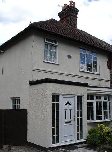 |
| H. G. Wells' House |
I’ve had the pleasure of travelling to Woking more than once and each time found it a delightful and interesting place. While this essay addresses some points of significance, it is by no means comprehensive. As you can see, the area is of great historical significance and well worth a visit!
Sources include:
British History Online. “Parishes: Woking” from A History of the County of Surrey Vol. 3, Pages 381-390. HERE
Celebrate Woking. “H.G. Wells and Woking.” HERE
All illustrations from Wikimedia Commons:
St. Peters Church HERE
Woking Palace HERE
Woking Crematorium HERE
Shah Jahan Mosque HERE
H. G. Wells' House HERE
~~~~~~~~~~
St. Peters Church HERE
Woking Palace HERE
Woking Crematorium HERE
Shah Jahan Mosque HERE
H. G. Wells' House HERE
~~~~~~~~~~